


Mad Co Teacher Resource Center, Madison County, Alabama
About
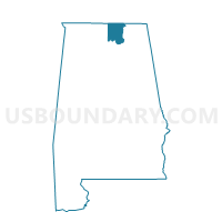
Outline

Summary
| Unique Area Identifier | 522416 |
| Name | Mad Co Teacher Resource Center |
| County | Madison County |
| State | Alabama |
| Area (square miles) | 7.11 |
| Land Area (square miles) | 7.04 |
| Water Area (square miles) | 0.08 |
| % of Land Area | 98.92 |
| % of Water Area | 1.08 |
| Latitude of the Internal Point | 34.79535450 |
| Longtitude of the Internal Point | -86.50994750 |
Maps


Graphs
Select a template below for downloading or customizing gragh for Mad Co Teacher Resource Center, Madison County, Alabama


Neighbors
Neighoring Voting District (by Name) Neighboring Voting District on the Map
- A&M University New Gym, Madison County, AL
- Chapman Middle School, Madison County, AL
- Chase Valley United Meth, Madison County, AL
- Lakewood Community Center, Madison County, AL
- Locust Grove Baptist Church, Madison County, AL
- Maysville Church of Christ, Madison County, AL
- Pleasant Springs Baptist Church, Madison County, AL
Top 10 Neighboring County Subdivision (by Population) Neighboring County Subdivision on the Map
Top 10 Neighboring Place (by Population) Neighboring Place on the Map
Top 10 Neighboring Unified School District (by Population) Neighboring Unified School District on the Map
Top 10 Neighboring State Legislative District Lower Chamber (by Population) Neighboring State Legislative District Lower Chamber on the Map
- State House District 21, AL (48,999)
- State House District 22, AL (48,959)
- State House District 19, AL (42,380)
Top 10 Neighboring State Legislative District Upper Chamber (by Population) Neighboring State Legislative District Upper Chamber on the Map
Top 10 Neighboring 111th Congressional District (by Population) Neighboring 111th Congressional District on the Map
Top 10 Neighboring Census Tract (by Population) Neighboring Census Tract on the Map
- Census Tract 108, Madison County, AL (9,826)
- Census Tract 101, Madison County, AL (9,355)
- Census Tract 107.02, Madison County, AL (7,199)
- Census Tract 102, Madison County, AL (5,516)
- Census Tract 2.02, Madison County, AL (4,399)
- Census Tract 2.01, Madison County, AL (760)